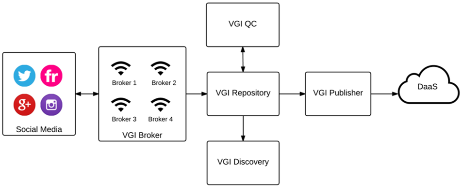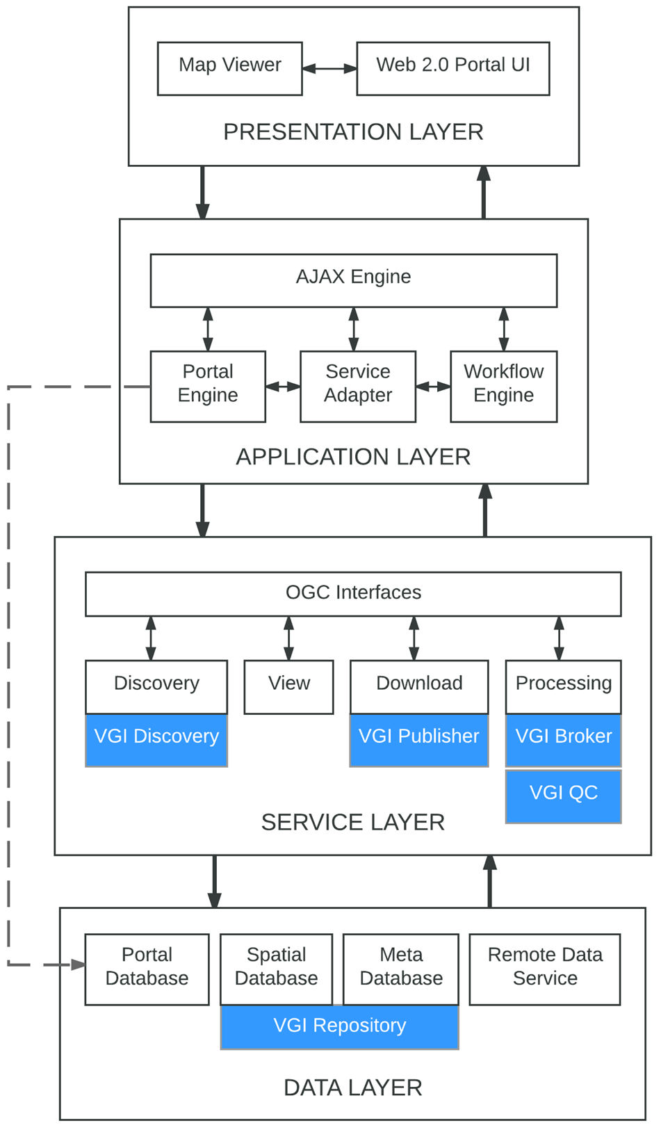
Information sharing plays an important role in raising situational awareness, delivering assistance to those affected by the crisis, and aiding in the development of mitigation plans. Disaster management platforms have the potential to foster that strategy by providing (online) tools that allow the collection, analysis, and distribution of spatial, temporal, and thematic information. Such platforms should be able to handle incoming crisis data, visualize information, and develop future scenarios.
The creation of geographic information by the public using Web 2.0-enabled collaborative methods has been labelled Volunteered Geographic Information (VGI) Although there are several successful examples of VGI used for emergency response, there is still a lack of efficient interoperable mechanisms for discovery, access, and use of V GI by disaster management platforms. These platforms should be able to integrate heterogeneous (geospatial) data of different type and quality from different resources.

Geodata1
A Volunteered Geographic Information Framework to Enable Bottom-Up Disaster Management Platforms